February 19, 2014

Still hiking... and thank you

This is my first post in more than four years. After completing many of the best hikes in Toronto, I've turned my attention to some of the best hikes in the world. I've climbed Mount Kilimanjaro (Tanzania) and hiked in the Peruvian Andes and Swiss Alps. My years of hiking in the Greater Toronto Area has prepared me well for these world-class adventures.

Thank you for your continued support and interest in this blog.

October 24, 2009

A Journey to Tobermory

Some of my favourite memories from the summer of 2009 involve hiking around the Bruce Peninsula. In August, Jade and I went hiking through several towns and provincial parks through the rustic northern landmass. During our two-day trip, we enjoyed an incredible variety of scenery. Although the hike was short by my standards (we covered no more than thirty kilometers over two days) it was one of my most memorable hiking trips thus far.

Jade and I start our four-hour drive on a sunny Thursday morning. Although we nearly get lost on the poorly-marked country roads of Simcoe County, we still manage to make great time and pass through Owen Sound before noon. We take a break in Wiarton, an elegant small town located along Lake Huron’s Colpoy’s Bay. The village, founded in the 1850s, features a number of rustic storefronts centralized along Berford Street. Wiarton is perhaps best known for Wiarton Willie, an albino groundhog who participates in the annual Groundhog Day festival. A large, solemn Willie statue stands in the middle of a beautiful park that runs along the shoreline of Lake Huron.

Continuing north, we drive along the seemingly endless Highway 6 and arrive in Tobermory after another hour. The tiny community is localized along a small bay that flows into Lake Huron. Numerous vessels, ranging from small sailboats to modest yachts, are located in the harbor. Tobermory probably has the largest number of boat & fishing supply stores per-capita in Ontario. The town is surprisingly small and, given that Jade and I aren’t looking for boat supplies, there doesn’t seem to be much to do. Tobermory is very isolated; Lion’s Head, the nearest community, is almost 50 kilometers away, and is connected by a single country road that bisects the vast cedar forest of the Bruce Peninsula. One could argue that Tobermory’s remoteness and simplicity is part of its appeal (a few people in town are wearing shirts that say “Gone to Tobermory, back whenever”).

In the early afternoon we drive to Bruce Peninsula National Park, located a few kilometers south of Tobermory. The Bruce is one of the largest and most diverse parks in Ontario. The government has provided Park status to a significant portion of the northern edge of the peninsula. The park is atypical because it features cedar forests, which is a rarity in southern Ontario. Jade and I hike along the Cyprus Lake trail and circle around a large, placid pond, which stands out like an oasis in the vast forest. The trail boasts great variety in scenery; there are peaceful brooks and jagged rocky formations standing five meters high (which I successfully climb).

After an hour of hiking, we arrive at the rocky edge of the Niagara Escarpment. Jade and I stand at the top of the rugged plateau; the view is breathtaking. The endless, clear Lake Huron extend towards the horizon. Beneath us, the escarpment plunges 10 meters downwards. Riskily, I decide to climb down the side of the bluff. Given that the escarpment is a rocky landform, there are many natural grips, which makes the descent easier. It takes less than five minutes for me to climb down and stand at sea level.

Although it takes me half an hour to convince her, Jade finally climbs down the rocky edge of the Niagara Escarpment. We walk along the slippery, narrow rocks and head into “The Grotto”, a large cave partially submerged in water. The Grotto provides shelter from the hot sun and is filled with eerily blue, placid, ice-cold water. Large rocks jut out from the ground and stalactites hang overhead. We take off our shoes and socks and dip our feet into the chilly pool. Although we’re able to walk in ankle-deep water through most of the cave, there’s an ominous, dark pool deeper inside the cave.

After cooling off in the Grotto, we climb back to the top of the escarpment. Although the sun is slowly sinking along the horizon, we decide to venture out even further. We walk along a seemingly endless section of the coastline consisting of little more than jagged rocks. The harsh, rugged terrain slows our pace to a crawl. (We run into a woman hiking across this inhospitable terrain, in the opposite direction; it turns out that’s she another accountant. What a bizarre place to run into a fellow number-cruncher). We rest for a few minutes at the far end of the beach, at the foot of a large bluff. Jade tries to teach me how to make a rock skip over water; I lack this talent.

While Jade rests, I quickly jog along the dark, ominous trail leading up the side of the bluff. The footpath is narrow, bumpy trail marked with faint chalk. The trail is quite dark, as the thick trees block most of the light from the setting sun. However, I make it to the bluff’s plateau and enjoy another great view of the placid Lake Huron from high atop the Niagara Escarpment. I jog back down the hill. After a quick rest, we make the long hike back to the parking lot, and drive back to Tobermory.

The next morning, we walk to the Tobermory waterfront and take a glass-bottom cruise through Fathom Five National Marine Park. The park is primarily aquatic, though it also contains several small islands. The boat takes us on a tour of the many shipwrecks in the shallow Georgian Bay. We get great views of many small islands from the top of the boat.

After a half hour cruise, the boat drops us off at Flowerpot Island. The island is a remote, uninhabited landmass located five kilometers northeast of Tobermory. The terrain is hostile; a thick, largely unexplored cedar forest occupies the center of the island and an unfriendly rocky shoreline encircles the terrain. Flowerpot Island is so-named because of two large rock formations along its eastern cost. Two rocky towers emerge from the rocky shoreline, and tower above the surrounding rocky shoals. Over hundreds of years, water has eroded the bases of the towers, causing them to look like large flowerpots. Small plants grow from the top of the natural structures. The flowerpots are among the most unique and stunning natural landmarks in Ontario.

We spend the rest of the afternoon hiking around the island. Initially, we follow the trail around the island’s coastline; this section is picturesque and relaxing. However, the hike becomes arduous as we curve inwards and bisect the island’s dense, hilly interior. The last few kilometers of the trail offer loose rocks, exotic vegetation and aggressive insects. We climb over small hills, trip over loose stones, and leap over narrow ravines. We try to explore off-path, but the vegetation is so dense we need to turn back after a dozen meters.

We take the boat back to Tobermory and drive south to Sauble Beach, a small town located along the coast of Lake Huron. The west side of town features a beautiful white sand beach that spans seven kilometers, bookended by the waterfalls in the north and an oak forest to the south. We see teenagers, young families and old couples sharing the beach; there’s plenty of waterfront to go around, especially compared to the crowded and relatively overrated Wasaga Beach. As the sun sets, it peaks from behind the clouds, casting unique patterns over the wavy lake. We take off our shoes and socks and walk, ankle deep, into Lake Huron. After two days of hiking, our feet feel rejuvenated by the soft, cool sand. As the sun rests on the horizon, we make the long drive back to Toronto.

The Tobermory trip ranks as one of my all-time favourite hiking trips, along with the 2007 Holland Land Keswick – Jackson Point trek and the 2008 Brampton – Erin – Orangeville marathon. These trips all combined great company, beautiful and varied scenery, and challenging distances and terrain. I always look forward to the next hike.

Labels:

September 3, 2009

A Journey to Christian Island

Earlier in the summer, I went on a sixteen-kilometer hike around Christian Island. Although it was a fairly short walk (by my standards), I was able to explore new, remote territory. It was my second (of three) summer trips to the Georgian Bay area, which is quickly becoming my favourite hiking locale in southern Ontario.


I drive to Cedar Point, a remote Native community located along the shoreline of Georgian Bay. Cedar Point is nestled within the vast birch forest spanning the northeastern edge of the Penetanguishene Peninsula. It’s a small and isolated hamlet, featuring a few dozen homes and several tiny stores. The village is a forty minute drive from Midland, the nearest major community. The exurb's highlight is a small dock and park that descends into Georgian Bay. I take the ferry across to Christian island and begin hiking into increasingly remote territory.


Christian Island, a small landmass located a few kilometers into the vast fresh water bay, is home to the Chippewa Natives. Originally a nomadic tribe, the Chippewas were encouraged by European colonists to settle on the small island. A tiny village is located along the southern edge of the island; it contains a community centre, a few small stores, and some houses. Several stray dogs wander around the dock, barking excitedly when they have the chance to chase after cars. Unfortunately it doesn’t look like there’s a lot to see in the community. I walk north along Ogema Road, the arterial path connecting the southern village with the remote northern shore.


North of the village, Ogema Road turns into a rough, bumpy gravel path. After a few kilometers, I turn onto a poorly-marked dirt trail that leads into the island’s vast interior forest. Although most forests in southern Ontario are deciduous, Christian Island offers a refreshing change of scenery as it features large, fertile cedar trees. The dirt path is narrow, muddy and curvy, and there are few signs of civilization. Although it’s a warm day, the tall cedars block out nearly all of the sunlight. The path splits into two after a few hundred meters – I don’t know where either half leads, but choose the western path. I look forward to the adventure.


The nature trail eventually leads to a sandy beach stretching across the island’s remote northern shoreline. The beach is quiet and secluded; there are no more than a dozen people out on the coastline, even though it stretches for many kilometers. The sand features interesting black, gray and tan patterns engraved by the Lake Huron tide. Hope Island, a small uninhabited land mass, is visible on the horizon.


I walk along the beach for about one kilometer until the sand fades and is replaced by an endless array of small, colourful rocks. Walking along the rocks seems like an interesting challenge – I carefully climb over the larger red, grey and tan stones, knowing that if I slip, I’d fall into Lake Huron. Progress is slow and steady, given that the rocks are uneven and slippery; it takes me fifteen minutes to cover the first few hundred meters. I contemplate circumnavigating the island via its rocky shoreline – it would definitely be a fun and scenic adventure, however I worry that I might not be able to finish until after sunset, which means I would be stranded on the island.

I continue along the jagged shoreline for a kilometer, carefully jumping from stone to stone. I’m far enough up the coast that I can no longer see or hear the other people on the beach. I rest on a large, red rock for a few minutes, alone, and enjoy the silence.


After resting along the rugged Georgian Bay shoreline, I make the long, exhausting walk back to the Christian Island community. I get a hamburger and fries at a small Native-owned diner adorned with Toronto Blue Jays memorabilia. The proprietor tells me how difficult it is to make a profit on the island, but he hopes that the unique décor will attract more customers. I wish him luck, walk back to the dock, and take the boat back to the mainland.

I watch the sun set over Christian Island from Cedar Point. After, I make the long drive back to Toronto and reflect on peaceful tranquility of the lush, green island.

Labels:

July 4, 2009

A Journey to Hamilton

In late May, I went on my third major hike of the year. During my 28-kilometer trip, I passed through Hamilton, Dundas, Flamborough and Aldershot. The trip was more interesting than I expected; I’ve been to Hamilton several times to visit Dan but I never realized how much great scenery was just a few kilometers north of the city.

Nathan and I take the Go bus to Hamilton and start walking a few kilometers west of the downtown core. Hamilton is a large industrial city with ample commercial amenities, making it fairly uninteresting from a hiker’s perspective. We exit the city and head north, towards the large, unnamed mountain just outside of town. We slowly ascend the steep hill and get a great view of Hamilton from a lookout point at the plateau. Rich, green vegetation extends all the way to Lake Ontario; the downtown Hamilton skyline is clearly visible in the distance.


Spencer’s Gorge, a large conservation area featuring some of the most stunning and varied scenery in southern Ontario, is located a few kilometers up the road. The entrance, featuring a park with a stream, is unassuming. However, as I walk along the stream, I notice a faint rumbling in the background. Following the noise, I arrive at Webser’s Falls, one of the largest waterfalls in Ontario. I descend using an old, creeky wooden staircase, into the heart of Spencer’s Gorge. Tall deciduous trees extend up from the muddy banks of the stream. The water flows rapidly before curving around a bend.


I notice a narrow, rocky ridge at the base of the waterfall, located a meter above the rapid-moving stream. Although it consists of soaking, crumbling rocks, covered in slippery algae, I think it’s just barely wide and stable enough to support me. Slowly and carefully, I walk along the narrow edge, putting my weight against the wall of the escarpment to ensure that I don’t follow onto the jagged rocks below. There’s a close call – I step on a combination of algae and dirt that immediately crumbles, but I grab onto the wall and barely keep my balance. After an agonizingly slow walk along the ledge, I finally make it to the rocky ridge directly behind the waterfall. Although I’m a meter behind the actual waterfall, Webster’s is so powerful that I’m soaked in a matter of seconds. Still, I sit there for a few minutes, enjoying the view and savoring the challenge.


After a slow, careful return to dry land, Nathan and I spend over an hour hiking through the vast wilderness within Spencer’s Gorge. Although there are some signs of human activity (shoe prints and litter), there are no formal trails in the gorge. Thus, the level of challenge (and safety) of this part of the hike is quite variable. Although many parts of the valley feature flat ground, there are many sections where we have to carefully step on stones to cross a stream, or maneuver along a narrow, muddy ledge elevated several meters above the river. We follow the river until we eventually reach a clearing, featuring railroad tracks and an otherwise empty field. Fortunately a few other hikers arrive within a few minutes and tell us about a shortcut that shaves five kilometers off our trip.


Following the hikers’ directions, we follow the railroad tracks for a kilometer until we find a sharp, ascending dirt path climbing up the side of the mountain. Eventually, we reach Dundas Peak, one of the most scenic lookout points in southern Ontario. The peak is a rocky, jagged ledge jutting out from the base of the mountain. It provides a great view of the Dundas and Hamilton skyline towards the south, and a vast, green forest to the north and west. There are no barriers or guardrails – the peak simply extends a few hundred meters above the forest floor below.


We spend the next hour hiking through the forest at the top of the mountain. Eventually, we find Tews’ Falls, one of the largest waterfalls in Canada, located at the northeastern edge of Spencer’s Gorge. A small stream of water plunges over a 40-meter vertical drop in the rock formation. That’s only a few meters shorter than Niagara Falls, though obviously Tews’ Falls has much lower volume. The valley below (which is accessible by a hiking trail that we were unable to find) is clouded in mist from the falls, and features a lush, green forest. Incredibly, I see a few girls walking along the stream, a few meters away from the crest of falls. If they slipped, they would fall to certain death below.


After exiting Spencer’s Gorge, Nathan and I hike east for an hour through flat, desolate farmland. Although the landscape is less interesting than the unique topography of Spencer’s Gorge, it still provides a welcome variety in the scenery.


Eventually, the terrain becomes rockier and the farmland is replaced by cottages, ravines, and endless green fields. We nearly get lost but, surprisingly, find a Sikh temple among the rolling hills. A few men give us directions to get into town. Generously, they also offer us food, water and invite us to rest in the temple for a few minutes so we can avoid the hot sun.


Eventually, we reach Aldershot, a small town on the southwestern shore of Lake Simcoe. We walk along the downtown core, which features a number of fairly generic plazas and restaurants. Unfortunately, we get stuck in a heavy thunderstorm which precludes us from exploring the town further; we were hoping to see Lasalle Park, which backs out onto Lake Ontario. We try to wait out the storm but have to walk to the Go train station after dark, during some moderate wind and rain.

Overall, this was one of my most memorable hikes. There was great scenery, and I avoided falling of a mountain. It was a good day overall.

Labels:

June 29, 2009

A Journey to Penetanguishene

I went hiking in the Georgian Bay area during the Victoria Day long weekend, passing through Awenda Provincial Park and the town of Penetanguishene. It was my second longest hike ever. I walked 56 kilometers during the two-day trip, though the flat terrain and unseasonably cool weather made it somewhat less arduous than I expected. This was one of my most memorable hikes due to the challenging distance and the fairly good variety in scenery.


Nathan and I drive to a small inn located a few kilometers outside of Penetanguishene. The inn is located on a secluded, quiet road nestled in the vast expanse of the Penetanguishene Peninsula forest. We head out on a bright, chilly morning and begin walking around Farlain Lake, a narrow, placid pool located just outside Awenda Park. Tall deciduous trees extend far into the distance. We walk along the paved road that encircles the lake, unfazed by the rain.


After a few hours, we arrive in Penetanguishene, a small town located on the shore of Georgian Bay. Originally a military base in the early 19th century, “Penetang” is now a peaceful community, boasting nearly 10,000 residents and a large, well-maintained harbor. Nathan and I walk through the vast, green Rotary Park, 40-hectare nature reserve that features the Georgian Bay shoreline, lush vegetation, and white sand beaches. Indeed, one of Pentenguishene’s best features is its proximity to unspoiled wilderness. The downtown core is located a few hundred meters from the waterfront, at the top of a hill, and includes the century-old St. Ann’s Church in addition to a mix of quaint and modern businesses.


Nathan and I walk back to the inn and nearly get lost at a fork in the road, though we successfully arrive at the inn before sundown. We drive to Midland, located a few kilometers to the south. Midland is somewhat larger than Penetanguishene and features more amenities, including a few generic suburban plazas; it also features a beautiful (though smaller and more industrialized) waterfront. We stop at a Greek restaurant, refuel, and rest at the harbor as the sun sets. By the time we drive back to the inn, it’s dark outside and dozens of stars are clearly visible. We’ve already hiked a great distance but have many more kilometers to go.


The next morning, we walk to Awenda, a large provincial park that extends from the forest just north of Penetanguishene to the shoreline of Georgian Bay. The south side of the park features tall, mature deciduous trees and several hiking trails with a considerable range in distance and challenge. Still, the real highlight is the beautiful coastline of Georgian Bay. Nathan and I walk along a paved, winding road for an hour until we arrive at the Bluff Trail, and enter the forest.


After walking through the forest for nearly two hours, we find ourselves near the edge of the Nippissing Bluffs, a 40-meter peak overlooking the clear, calm Georgian Bay. Nathan and I head downhill, past a thick cluster of trees, and suddenly find ourselves standing on the shoreline. The vast, blue Georgian Bay extends into the horizon. We see Giants’ Tomb, a small, mountainous, uninhabited island located a few kilometers into the lake. After walking along the jagged, rocky shoreline for an hour, we return to the main trail.


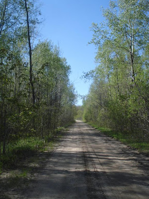
I start feeling the first signs of fatigue as we walk down a long, winding path that runs east towards the community of Sawlog Bay. It takes over an hour just to leave the park’s boundary. Unfortunately, Sawlog Bay is uninteresting and features little more than a long string of summer cottages. Eventually Nathan and I turn south onto Bush Road, a desolate dirt path winding through the forest. This trail is probably more barren and untouched than Awenda; there are no signs of human activity and vegetation interposes upon the twisted trail. Many animal sounds emanate from the forest. After walking for an hour through the woods, Bush Road connects with Champlain Road, the last stretch of our journey.


The final portion of the walk is difficult as Champlain Road ascends mercilessly. Exhausted and approaching the 50 kilometer mark, we slowly but relentlessly continue onwards, determined to make it back to the inn before sunset. Fuelled by runners’ high, we barely notice our second trip around the placid Farlain Lake and somehow manage to arrive back at the inn. We rest for an hour but spend the second consecutive night in Midland, eating & enjoying the waterfront.

Overall, this was one of the most interesting and challenging hikes I’ve taken. Many thanks to Dino, the inn’s owner, and his other guests (a couple from Innisfil) for insights about the best route to take, complementary hiking supplies, and many interesting conversations about hiking, travel and life.

Labels: